| Home |
| Early Life |
| Maps |
| Oregon Laws |
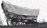
| The Trail |
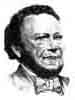
| Bush Biography |
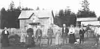
| Tumwater Born |
| Thurston County |
| State History |
| Bush
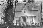
Farm Today |
| FAQs |
| Timeline |
Boundary Line Placement Timeline
| Oct..20 |
1818 |
Treaty signed for
joint British-American
occupancy of Oregon Country |
| 1824 |
Dr. John McLoughlin
founded
Fort Vancouver with the closing of Fort George
(Astoria) |
|
| 1825 |
McLoughlin informed
by Hudson
Bay Company directors in England that the area
south of Columbia River was
not going to be claimed by Great Britain |
|
| 1827 |
Joint occupancy
agreement extended |
|
| 1836 |
Fort Vancouver (in
Washington
State) consisted of 3,000 acres with 2 sawmills
and 2 grist mills.
Fort measured 750 by 450 feet |
|
| Aug |
1845 |
Vancouver (Clark) County established north of Columbia River by American Provisional Government with Sir James Douglas, Michael T.Simmons, and John Forrest as Commissioners |
| Aug |
1845 |
Britishers Henry James Warre and Mervin Vavasour explore from Willamette to Victoria for the Royal Army and prepare a report that specifies that Puget Sound cannot be defended from American settlers |
| Apr 28 |
1846 |
President Polk gave
notice to
Prime Minister Peel that joint occupancy treaty
must be terminated |
| Jun 6 |
1846 |
British government
proposed
49th parallel as the boundary in a communication
to American government |
| Jun 15 |
1846 |
Treaty accepted and
signed by
Congress in Washington, DC |