| Home |
| Early Life |
| Maps |
| Oregon
Laws |
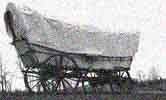
| The
Trail |
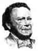
| Bush
Biography |
| Tumwater
Born |
| Thurston
County |
| State
History |
| Bush Farm Today |
| FAQs |
| Timeline |
|
ORIGINAL
SURVEY
OF
TOWNSHIP
17 IN 1853 - CONTRACT 33 Field Notes of the Survey of the
Exterior Lines of the
Townships 17, 18, 19, & 20 North of Range 1 West Willamette
Meridian in the
Territory of Washington by Geo. W. Hyde & Josiah W. Preston, Deputy
Surveyors under the Contract No.
bearing date the 8th day of April 1853 Exterior Lines T 17,18,19 & 20 N
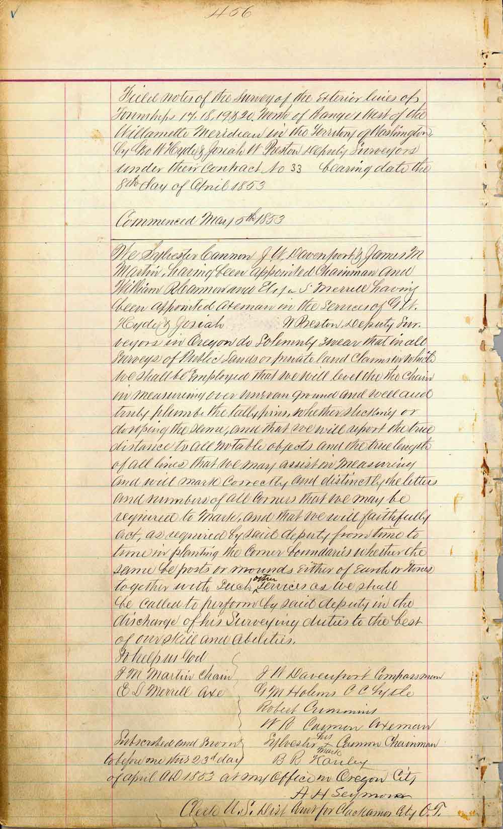
of R No. 1 West. Hyde and Preston ************************************************** Field notes of the Survey of the Exterior lines of Townships 17, 18, 19 & 20, North of Range 1 West of the Willamette Meridian in the Territory of Washington, by Geo W Hyde & Josiah W Preston Deputy Surveyors under their Contract No. 33 bearing date the 8th day of April 1853 Commenced May 5th 1853
We Sylvester Cannon J. W. Davenport & James M. Martin, having been appointed axeman in the services of J. W. Hyde & Josiah W Preston, Deputy Surveyors in Oregon do Solemnly swear that in all Surveys of Public Lands or private land claims in which we shall be employed that we will level the XXX chain in measuring over uneven ground and well and truly plumb the tally pins, whether sticking or XXXX the same, and that we will report the true distance to all notable objects and the true length of all lines that we may assist in measuring and will mark correctly and distinctly the letters and numbers of all corners that we may be required to mark, and that we will faithfully act, as required by said deputy from time to time in planting the corner boundaries whether the same be posts or mounds either of earth or stones together with such other services we shall called to perform by said deputy in the discharge of his surveying duties to the best of our skill and abilities, so help us God J. M. Martin Chain, E. L. Merrill Axe, J.W. Davenport Compassman, G. M. Holms, C. C. Lytle, Robert Cummins, W. R. Cannon Axeman, Sylvester Cannon (X his mark) Chainman, B. R. Kanley. Subscribed and sworn before me this 23rd
day of
April 1853 at my office in Oregon City
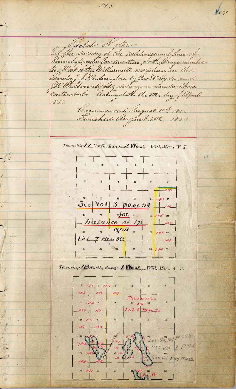
Of the Survey of the subdivision lines of Township number seventeen, North Range number two West of the Willamette Meridian in the Territory of Washington, by Geo. W. Hyde and J.W. Preston deputy surveyors, under their contract No. bearing date the 8th day of April 1853. Commenced August 15th, 1853 Finished August
30th, 1853
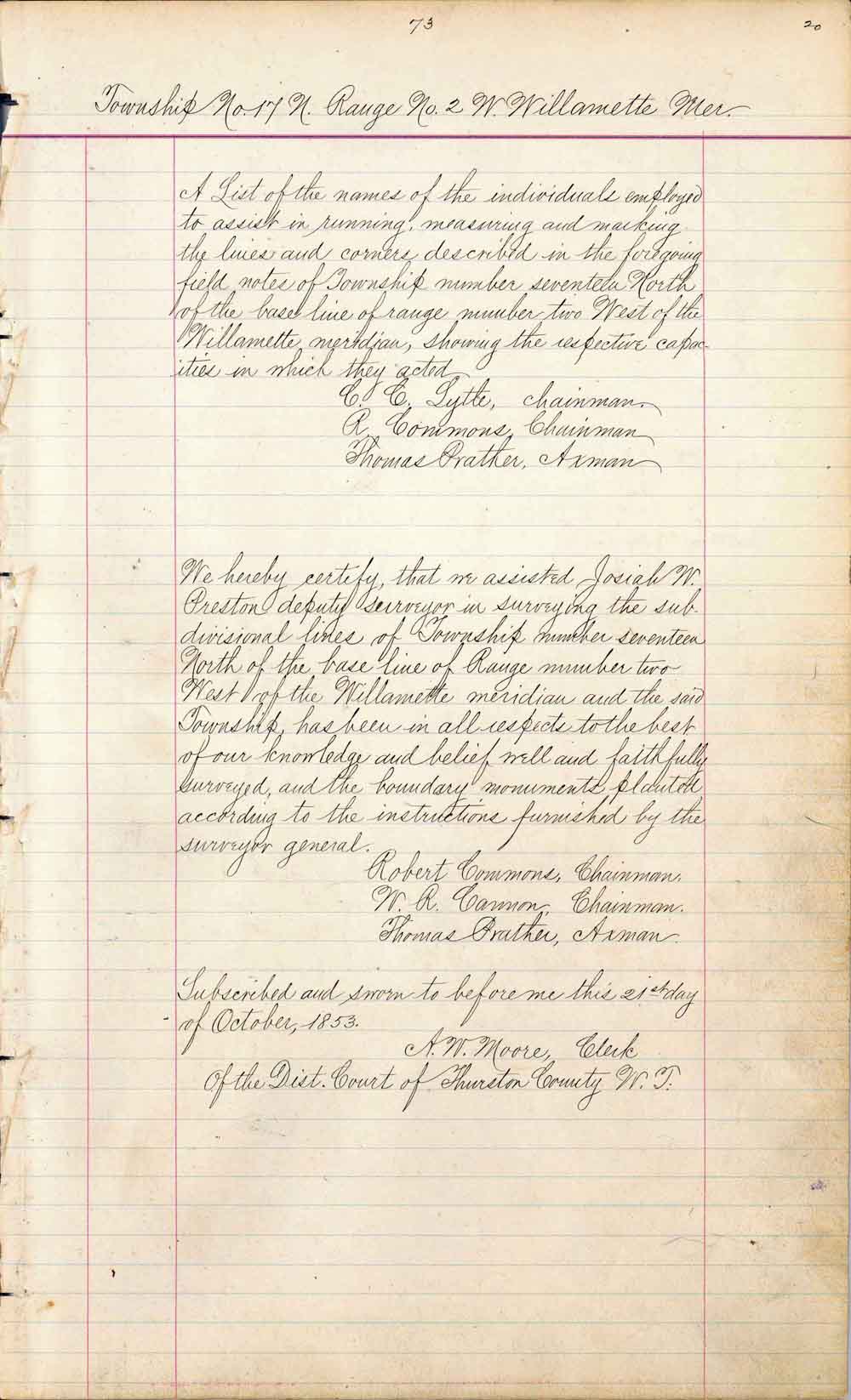
Township No. 17 N. Range No.2 W. Willamette Mer. A
List of the names of the individuals
employed to assist in
running, measuring and marking the lines and corners
described in the foregoing field notes of Township
seventeen
North of the base line of range number two West of Willamette meridian,
showing
the respective capacities in which they acted C. C. Lytle, chainman R. Cummins, chainman Thomas Prather, chainman We hereby certify that we assisted Josiah W. Preston deputy surveyor in surveying the subdivisional lines of the Township number seventeen North of the base line of Range number two West of the Willamette Meridian and the said Township, has been in all respects to the best of our knowledge and belief well and faithfully surveyed, and the boundary monuments planted according to the instructions furnished by the surveyor general. Robert Cummins, Chainman W. R. Carmon, Chainman Thomas Prather, Axman Subscribed and sworn to before me this 21st day of October 1853. A. W. Moore, Clerk of the District
Court of Thurston County
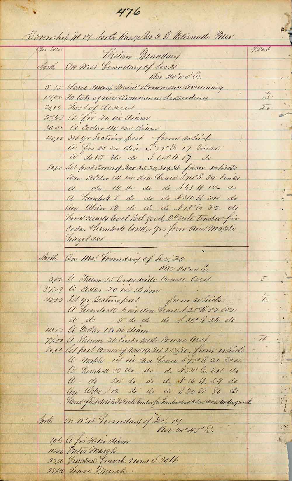
From BLM - Part 5 Township No. 17 North Range No. 2 W Willamette Meridian
|